Amber alert for parts of northern England as heavy snow forecast
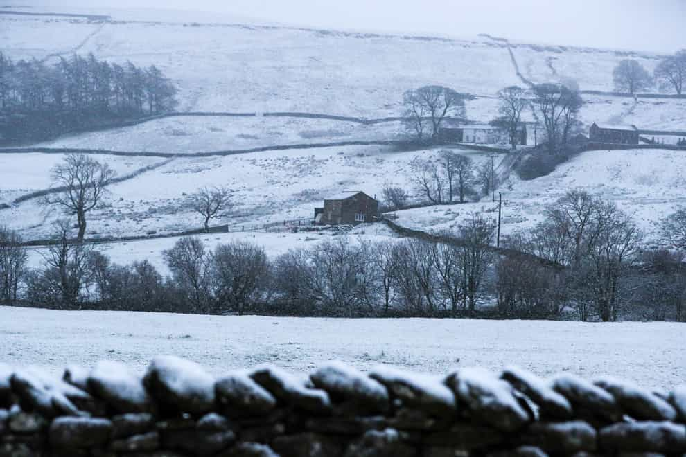
Parts of northern England have seen heavy snowfall overnight, with the Met Office warning rural communities are at risk of becoming cut off and widespread travel disruption is likely.
An amber weather warning for snow came in force across much of South Yorkshire, and parts of Derbyshire, West Yorkshire and Greater Manchester at 3am on Tuesday and will last until 1pm.
Between 3cm and 8cm of snow is likely across the area, with 10cm to 15cm possible in areas above 200 metres.
Overnight, vehicles became stuck on the eastbound M62 near Rochdale, Lancashire, between junction 21 for Milnrow and junction 22 for Denshaw leading to a temporary closure of the carriageway, and a lorry jack-knifed on the same motorway westbound between junction 23 and junction 22 in the early hours.
Forecasters said motorists who brave the roads are at risk of becoming stranded, while rail and air cancellations are likely.
Power cuts and disruption to mobile phone coverage are also expected, while rural communities face being cut off completely.
The snow is expected to move north over the course of Tuesday morning, before clearing and becoming brighter from the south in the early afternoon.
Over the next seven days, much of Scotland is also bracing for icy and snowy conditions.
Elsewhere, there is a yellow weather warning for rain and snow across County Derry and County Antrim in Northern Ireland in force until midday on Tuesday, meaning flooding is possible.
An alert for snow and ice is also in place from central Scotland down to the Midlands until midnight on Tuesday, which is likely to affect public transport and motorists.
Between 5cm and 10cm of snow could fall over higher ground in southern Scotland and northernmost counties in England with the possibility of 20cm or more across the highest roads.
A concentrated band of heavy rain running from County Durham through the middle of Yorkshire is due to fall between 6pm on Tuesday and 4am on Wednesday bringing travel delays and localised flooding.
Over the later half of the week, a yellow warning for snow is in place in northern Scotland until 6am on Saturday, potentially leading to rural communities being cut off.
It is a much milder picture further south, with temperatures hitting 10C (50F) in Cornwall on Monday compared with lows of minus 7C (19.4F) in northern Scotland.
With the milder weather comes persistent rain and multiple flood risks.
There are currently 53 flood warnings from the Environment Agency in place across England, with a further 154 flood alerts.
Natural Resources Wales has issued three flood alerts, one for the Carmarthenshire coast, one for Upper Severn in Powys and another for south Pembrokeshire.
Jason Kelly, Met Office deputy chief meteorologist, said: “While the south of the UK hangs on to the milder air for much of this week as we approach the weekend, the area of low pressure responsible for the snow across the north of the UK will clear, allowing colder air to push south and west across much of the country.
“Further snow is expected for most parts of Scotland on Friday, while Saturday will be cold for all.”
The best videos delivered daily
Watch the stories that matter, right from your inbox