More torrential rain forecast after communities hit by flooding
Forecasters are warning of more heavy rain and thunderstorms after some parts of the country were hit by flooding.
Two yellow weather warnings have been issued by the Met Office, covering much of southern and central England and Wales on Thursday.
They predict heavy rain and thunderstorms which may bring the risk of flooding and travel disruption.
Slow-moving, isolated showers could see 1.2in to 1.6in (30mm-40mm) of rain fall in some places over two to three hours.
Met Office spokeswoman Nicola Maxey said such “torrential downpours” could trigger flash flooding.
Videos shared on social media revealed the extent of flooding in some areas on Wednesday night.
Ryan Shelton posted footage on Twitter of a submerged street in Ilkeston, Derbyshire, and said the flooding was “worse than ever”.
Mr Shelton, a 34-year-old sales manager, told the PA news agency that it was “quite scary” how 20 minutes of rain from 5.30pm left 4ft (1.2m) of floodwater.
Floodgates protected the front of his home, but water entered the back via sewage pipes leaving a “dreadful” scene.
He said residents were given only six sandbags to protect 20 houses, and they worked to unblock drains on the street themselves.
He added: “Unfortunately it left devastation in its wake in terms of the debris on the road, multiple cars had been flooded out.”
Another clip from Wednesday showed water pouring down on Broughton Street in Beeston, Nottingham.
Meanwhile on Thursday, Darren Bell, 54, an operations manager, said he “started to panic a little” as he watched floodwater wash up towards his home in Bournemouth at around 12.35pm.
He recorded video of traffic splashing through water on his street, saying he was “shocked to see how quickly it was building up”.
Mr Bell said it was “all very sudden” and a “few inches deep and overflowing into the properties opposite”.
He added: “Myself and other neighbours redirected traffic as it’s a very busy road.”
Natural Resources Wales tweeted on Wednesday evening that it had sent officers to the village of Pentre in the Rhondda Valley after thunderstorms caused surface water flooding in many areas.
Almost 200 properties were flooded overnight in parts of South Wales, with Pentre being the worst hit – four months after it was hit twice by flooding during Storm Dennis.
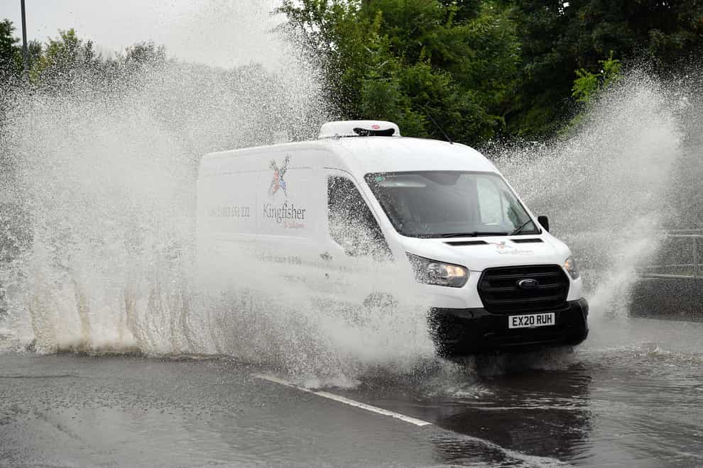
Another video shared online by the Environment Agency showed cars driving through a flooded street in Birmingham on Wednesday.
A Met Office yellow warning was in place until noon on Thursday which stretched across Wales, the Midlands, East Anglia and parts of London and the South East.
It warned that heavy rain could bring some “localised disruption”, with the flooding of a few homes and businesses likely.
Bus and train services were likely to be affected, with car journeys lengthened by spray and flooding on the roads.
Ms Maxey said 0.2in to 0.4in (5mm-10mm) of rain was expected to fall during the period of the warning, with heavier downpours bringing 1.2in to 1.6in (30mm-40mm) over three to six hours.
A second weather warning covering southern England, East Anglia and South Wales is in place from 11am until just before midnight on Thursday.
Forecasters say “slow-moving heavy showers and thunderstorms” may lead to disruption due to flooding.
Ms Maxey said downpours could bring 0.8in to 1in (20mm-25mm) of rain within one hour in some areas, with the potential for 1.2in to 1.6in (30mm-40mm) in two to three hours in a few spots.
She explained: “These are the heavier showers, not everywhere within the warning will see these heavier showers. These are the isolated ones.
“These are the ones that have the potential to cause issues such as flash flooding.”
The Met Office website warns there is “a small chance that homes and businesses could be flooded quickly, with damage to some buildings from floodwater, lightning strikes, hail or strong winds”.
It also expects there to be “a small chance of fast-flowing or deep floodwater causing danger to life and some communities becoming cut off by flooded roads”.
As of 4pm on Thursday, the Environment Agency had six flood alerts in place for England in areas around Birmingham, Solihull, Tamworth, Loughborough and south of Wolverhampton.
These advise people to “be prepared” as flooding is possible.
The best videos delivered daily
Watch the stories that matter, right from your inbox