UK faces ‘timeline of different hazards’ as Storm Christoph moves in
The country faces a “timeline of different hazards” this week as Storm Christoph moves in, a weather forecaster has said.
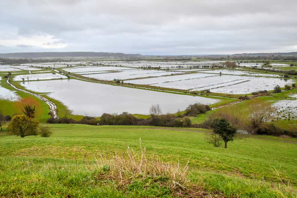
Weather warnings for heavy rain are in force across the UK, but the unsettled conditions could also bring the risks of wind and snowfall as the storm engulfs the country through the middle of the week.
Met Office spokesman Oli Claydon said that rain is “initially” the main concern but the picture will change as low pressure could introduce colder air.
He explained: “As we go through the week and the low pressure that is bringing these fronts of rainfall that are persistent and heavy over the next few days … as that low pressure moves east and out into the North Sea, the winds will become a thing really later in the week.
“Also as the low pressure moves away it pulls down a north-westerly airflow which brings much colder air across the UK again which then presents a further risk of snow.”
Mr Claydon described the situation as “a timeline of different hazards as we go through the week but the first hazard is certainly of rain and that’s reflected in the warnings at the moment”.
The most serious weather warning – amber for rain – has been in place across parts of the Midlands and northern England since Tuesday morning, alongside less serious yellow warnings for rain across Wales, Northern Ireland, northern England and southern Scotland.
The highest rainfall recorded overnight was in Aberllefenni, west Wales, where 35.4mm fell between midnight and 8am on Tuesday.
Of the areas in the amber warning zone, Bolton in Greater Manchester has seen the most rain so far, with 24.4mm over the same period.
By Wednesday, the yellow warnings for rain will stretch south to additionally cover all of England, all of which remain in place until midday on Thursday, alongside the more serious amber warning in central England.
Eastern Scotland is also facing a yellow warning for snow and from Wednesday afternoon through to Thursday lunchtime, with the threat of travel delays, power cuts and rural communities being isolated.
Mr Claydon added: “It’s not going to be a short burst of bad weather like you may think of in terms of storms in the past where it quickly blows through overnight.
“It’s really persistent heavy rain, the rain really is going to be persistent, just continuing all the way through today and tomorrow and into Thursday, it’s really just the prolonged accumulation of rainfall rather than a short come and gone weather event,” he said.
On Tuesday, the Environment Agency had issued 15 flood warnings and 117 less serious flood alerts across England.
Floodwaters have already risen in parts of the country, with a motorist pictured stranded in Leicester, and workmen in York prepared flood defences on Tuesday morning near the city’s River Ouse.
A major incident has already been declared in South Yorkshire in anticipation of flooding that could arrive in the coming days.
Mayor of Doncaster Ros Jones tweeted on Monday evening: “Key risk areas have been inspected over the past 36 hours, sand-bags have been handed out in flood-risk areas & will continue over the next 24 hours.”
The Local Government Association (LGA) has advised people to check with councils to keep up to date with advice as the storm moves through.
The LGA said in a statement: “They will share flood warnings and other relevant information so people should make sure they regularly check their council’s website and social media and follow their advice.”
The best videos delivered daily
Watch the stories that matter, right from your inbox